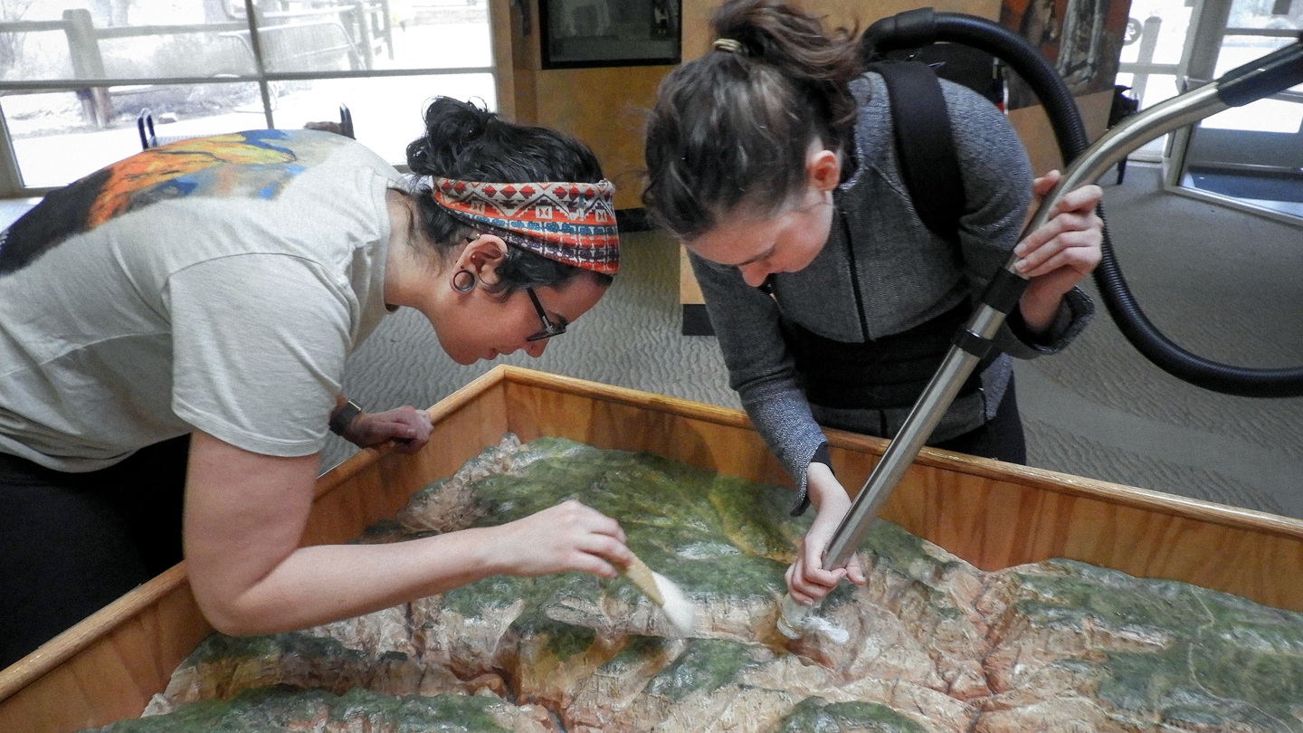
Conserving Zion Canyon’s Depression-Era Topographic Map
During the height of the Great Depression in 1934, a topographic relief map of Zion Canyon was created at the National Park Service Western Museum Laboratory in Berkeley, California (museum catalog #ZION 274). This map was originally housed in the Mission 66 Visitors Center and has been orienting visitors to the land contours, river segments, and other points of interest in Zion Canyon for 85 years. A snapshot of Zion in the 1930s, it’s the only orientation of its kind in the park collections. The map is currently displayed in the Zion Human History Museum, located at the second shuttle stop and home to the Zion park film. Despite its long history of display, the topo map has received relatively little documented conservation attention.
In 1969, the Zion Forever Project funded the first repairs to this historic map. Fifty years later, this cultural and educational treasure remains a priority. Due to its age and exposure to visitors, the map is worn and currently lacks labeling for visitors to identify important features. This gift to the park would support the installation of a touchscreen kiosk identifying place names of distinct features, explain geography in the park, and link to the park’s collection of historic images. It also provides professional conservation, including installation of a plexiglass barrier forever protecting the map from direct visitor contact. Decades after Zion’s park management began utilizing topography as a tool to help guests interpret the majesty of Zion Canyon, Zion looks to continue that tradition in 2020 by blending historic mapping techniques and modern technology.